



Key actors — tap for context

Berkeley Earth
A nonprofit research organization based in Berkeley, California, that independently processes and publishes global temperature data.
Why here: Reconstructed temperatures directly at the site of the break-off and provided the first figure for the disaster.
More info →Robert Rohde
An American physicist and lead scientist at Berkeley Earth, specializing in the processing of long-term temperature series.
Why here: Author of the analysis. Calculated that without warming, a comparable situation would occur once every few thousand years.
More info →
Valérie Masson-Delmotte
A French climatologist, co-author of the UN Intergovernmental Panel on Climate Change report on the ocean and cryosphere.
Why here: Explains how the breakdown of permafrost weakens rock faces.
More info →Kristen Cook
A geomorphologist at Grenoble Alpes University, specializing in landslides and mountain slope dynamics.
Why here: The leading voice of caution. According to her, temperature only played a role because the massif was already right on the verge of failure.
Étienne Berthier
A glacier expert at France's National Centre for Scientific Research (CNRS), specializing in satellite monitoring of glaciers.
Why here: Pointed out significant snowmelt in the days just before the collapse.

Langtang
A Himalayan valley and mountain range north of Kathmandu near the border with Tibet, known for its trekking routes.
Why here: Site of the disaster. This year's summer there was the fourth-warmest since 1970.
More info →
Trishuli
A river in central Nepal, on which hydropower plants of the same name are located.
Why here: The wave surged through its valley. Search teams are still looking for missing people in the plants' tunnels.
More info →Jan Kavan
A glaciologist at the Centre for Polar Ecology of the University of South Bohemia in České Budějovice, specializing in glacier dynamics and polar regions.
Why here: Refuted the claim that the disaster was caused by the construction of a Chinese hydropower plant.
Copernicus
The European Union's Earth observation program, which operates satellites and the ERA5 climate model.
Why here: Source of the data from which Rohde reconstructed the temperatures.
How temperature can be calculated where no one measured it
Temperatures directly at the site of the break-off were reconstructed by Berkeley Earth's lead scientist, Robert Rohde. He drew on the ERA5 climate model of the European Copernicus program and on data from fourteen high-altitude weather stations located nine to 140 kilometers from the glacier. The model also gives him a longer-term view. The average temperature for this August period is today roughly 1.8 degrees higher than it was in the mid-20th century. Pravda ↗Rohde adds a sentence that is the core of the whole analysis. Without the additional heat from climate change, a comparable temperature situation, according to his calculation for AFP, “would probably occur only once in a few thousand years”. Yet, according to Copernicus data for the years 1970 to 2026, the summer of 2026 was the fourth-warmest in the Langtang area, with the record set two years ago. Onlinekhabar ↗
Why scientists are still holding back
None of the experts contacted claim that the heat caused the disaster. Geomorphologist Kristen Cook of Grenoble Alpes University points out that high temperatures did not necessarily have to lead to the collapse: if temperature acted as a trigger, it seems this could only have happened because the rock massif was already very close to its breaking point. According to her, scientists are now examining small movements recorded in the range in the years before the landslide and their connection to temperature trends. ta3 ↗Rohde himself named what would count as real proof. If it were shown that meltwater or thawing permafrost had noticeably weakened the rock at the fracture surface, that, according to him, would be a “smoking gun” of climate change. So far, no such proof exists. Onlinekhabar ↗
The mechanism being discussed is, in fact, well known. Permafrost, that is, permanently frozen ground, acts as an icy cement holding rock walls together, and as it breaks down it contributes to their instability — notes climatologist Valérie Masson-Delmotte, co-author of the UN climate panel's special report on the ocean and cryosphere. Glacier expert Étienne Berthier of France's CNRS adds that satellite images showed significant snowmelt in the days before the disaster, meaning a source of liquid water that can penetrate cracks in the mountain. ta3 ↗
In two weeks, the main thing hasn't moved
While the scientific figures keep growing, the final tally is closing very slowly. As of Tuesday, Nepal's Disaster Management Authority has recorded 1,358 bodies found and 5,326 people missing, while on the Chinese side state media report 43 dead and 519 missing. Rescue and search operations in the tunnels of the Trishuli 3A, 3B, and Chilime hydropower plants are still continuing, according to Nepalese army spokesman Raju Ram Basnet. The last survivors — two Nepalis and one Chinese national — were pulled out on Friday and Saturday. Since then, authorities have not confirmed any further finds. SITA ↗Nor has what we wrote about in early September moved. The early warning system that German scientists from the GFZ center in Potsdam developed for Nepal still has no funding. It is a network of about 80 seismometers with software trained to recognize the vibrations typical of a flash flood. The network would then send a warning to residents' phones. The proposal has been sitting without funding for several years, and building and operating it would cost around eight million euros. Germany's Research Ministry did not respond to the question of whether it would reassess the project after the disaster. RiffReporter ↗
Also read: The warning system for Nepal has been waiting years for funding. The German government refused to pay for it
One thing must be added, though, so the two things aren't confused. The seismic system does not measure heat or permafrost, so it would not have detected what Berkeley Earth is now analyzing, and it would not have prevented the landslide. It would only buy minutes — according to its developers, in the case of another Himalayan flood from 2021, the warning would have arrived about eleven minutes in advance — enough for people to run sideways up the slope. GFZ ↗
Conspiracy theory about the Chinese dam
Meanwhile, a claim has spread on social media that the disaster was caused by the construction of one of the Chinese hydropower plants near the collapsed glacier. Experts reject this. Glaciologist Jan Kavan of the Centre for Polar Ecology at the University of South Bohemia told the iROZHLAS fact-checking project Ověřovna that the power plant's construction could hardly have had such an effect on the glacier's collapse. According to him, the cause was natural processes, not the construction. iROZHLAS ↗An information vacuum on the Chinese side feeds this. According to the newspaper Deník, relatives of the missing from the border area of Gyirong have compiled their own unofficial list of victims precisely because official data is scarce. Locals speak of harsh censorship, which state propaganda denies. Deník ↗
What hotinfo is following
- Berkeley Earth alebo iný tím zverejnil recenzovanú atribučnú štúdiu ku katastrofe pod Langtangom.
- Vedci zverejnili výsledky výskumu drobných pohybov masívu zaznamenaných v rokoch pred zosuvom.
- Vedci doložili alebo vylúčili, že horninu pri lomovej ploche oslabila voda z topenia alebo rozmŕzajúci permafrost.
- Nepálske úrady zverejnili konečnú bilanciu obetí a nezvestných.
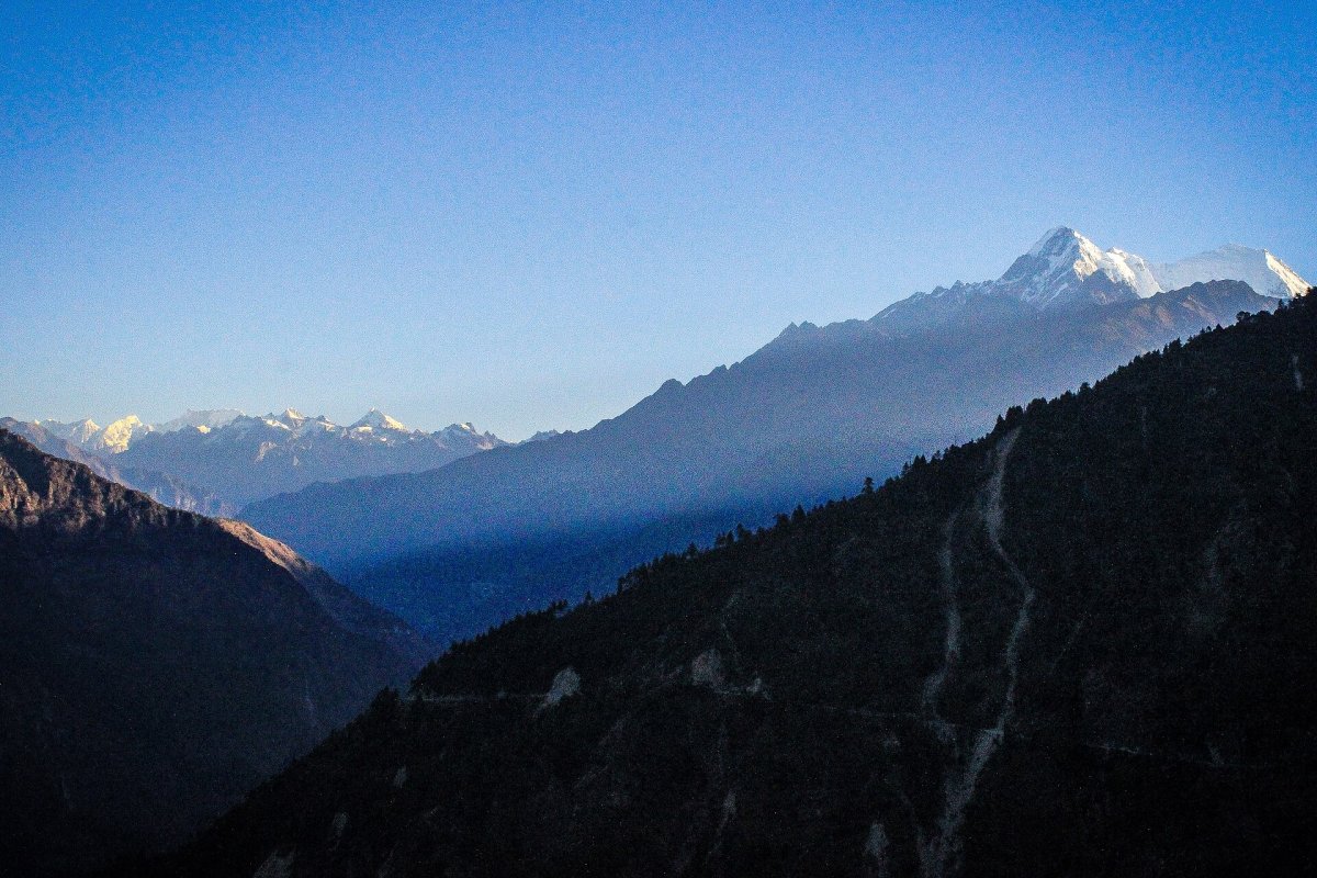
*Photo: the Langtang Himal and Luri Himal massif in Langtang, Nepal, archive photo. Author: Saroj Pandey / Wikimedia Commons / CC BY-SA 4.0. Image has been resized.*